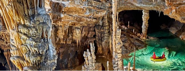
Karst caves are some of the most mysterious and fascinating natural formations on our planet. They hide many secrets, from unique geological structures to unexplored life forms. Traditional methods of cave exploration are often associated with dangers and limitations, but with the development of modern technology and computer systems, the study of underground worlds has reached a new level. In this article, we will look at how digital technologies are transforming the approach to exploring karst caves, making it more efficient, safer and informative.
1. 3D scanning and modeling of caves
1.1. Laser scanning (LiDAR)
Laser scanning, or LiDAR (Light Detection and Ranging), has become one of the most effective tools for high-precision mapping of cave systems. Using laser pulses, LiDAR devices are able to create detailed 3D models of cave interiors with millimeter accuracy.
- High accuracy and detail: Allows researchers to obtain a complete picture of the cave geometry, including small details and relief features.
- Speed of data collection: The fast scanning process reduces the time required to conduct on-site research.
- Safety: Reduces the need for physical presence of people in dangerous or hard-to-reach areas of caves.
1.2. Photogrammetry
Photogrammetry is a method of creating 3D models based on a series of photographs taken from different angles. Modern software products are able to process these images and generate accurate 3D representations of cave structures.
- Equipment availability: Conventional digital cameras or even smartphones can be used for shooting.
- Visual realism: The resulting models are highly photorealistic, which is important for presentations and educational purposes.
- Flexibility of application: The method is suitable for various scales, from large halls to small formations inside caves.
2. Geographic Information Systems (GIS) in Speleology
Geographical information systems play a key role in the analysis and management of spatial data related to caves.
2.1. Mapping and data analysis
GIS allows you to combine different types of data – geological, hydrological, biological – in a single system for complex analysis.
- Data integration: Brings together information from different sources for a deeper understanding of cave systems.
- Risk analysis and route planning: Helps to assess potential hazards and optimize research or tourist excursion plans.
- Change monitoring: Allows you to track the dynamics of changes in caves associated with natural processes or human activity.
2.2. Management and conservation of cave ecosystems
GIS can be used to effectively manage conservation efforts for unique cave ecosystems by identifying vulnerable areas and developing strategies for their protection.
- Environmental monitoring: Tracks the state of flora and fauna, as well as the impact of external factors on the ecosystem.
- Spatial planning: Helps in decision making on access restrictions to certain areas to preserve the natural balance.
- Educational resources: Create interactive maps to educate and raise awareness about the importance of preserving cave systems.
3. Robotics and automated exploration systems
3.1. Drones and underground drones
The use of drones and specialized underground drones opens up new possibilities for exploring difficult or dangerous areas of caves.
- Access to dangerous areas: Allows exploration of areas that are inaccessible or too risky for humans.
- Collection of diverse data: Equipped with cameras and sensors, drones can collect visual, temperature, chemical and other types of data.
- Speed and efficiency: Quickly cover large areas with minimal resource expenditure.
3.2. Exploration robots
The development of specialized robots for cave exploration provides new tools for deep and detailed study of underground structures.
- Adaptability to the environment: Robots can be designed to navigate complex terrain, including narrow passages and vertical shafts.
- Long-term missions: Capable of conducting long-term explorations without the need to return to base frequently.
- Multi-sensory equipment: Equipped with various sensors to collect complex data on the physical and chemical environment of caves.
4. Virtual and augmented reality in cave exploration
4.1. Virtual tours and educational programs
Virtual reality (VR) technologies make it possible to create interactive cave tours, making them accessible to a wide audience without the need for a physical visit.
- Accessibility: Allows people with “visit” caves around the world, including those that are closed to the public or located in remote areas.
- Educational value: Interactive elements help to better understand the geological processes and ecological significance of caves.
- Conservation of natural sites: Reduces human impact on fragile cave ecosystems by reducing the number of physical visits.
4.2. Augmented Reality (AR) in Field Research
AR technologies can be used by cavers to obtain additional information in real time directly at the research site.
- Improved navigation: Displaying digital maps and data on top of the real image helps to navigate complex cave systems.
- Access to real-time data: Instantly access information about geological layers, temperature, humidity and other parameters.
- Facilitated communication: Ability to share data and coordinate actions between team members in real time.
5. Big Data Analysis and Artificial Intelligence
5.1. Data Processing and Interpretation
Collecting huge amounts of data during research requires effective methods for processing and analyzing it. This is where big data and machine learning technologies come in.
- Identify hidden patterns: Machine learning algorithms can detect complex relationships and trends in data.
- Process forecasting: Model and predict changes in cave systems, including possible collapses or changes in hydrological regimes.
- Optimize research: Data analysis helps to better plan future expeditions and focus resources on the most promising areas.
5.2. Automatic detection and classification
Artificial intelligence can be used to automatically recognize and classify various objects and structures inside caves based on the collected data.
- Reduce analysis time: Automation of recognition processes significantly speeds up data processing.
- Increase accuracy: Eliminating the human factor reduces the likelihood of errors in identification and classification.
- New discoveries: The ability to detect previously unnoticed features and anomalies in cave systems.
Quick Fix Computer Repair: Keeping Things Running in Karst Cave Research
Modern technologies such as 3D modeling and GIS play an important role in karst cave research, but it is equally important to keep the equipment used in these studies running smoothly. When technical issues arise, a quick fix computer repair solution becomes critical. Rapid diagnosis and troubleshooting of computer systems can help avoid delays in field work and ensure the safety and accuracy of the data collected.
Conclusion:
The integration of modern technologies and computer systems into speleology is radically transforming the methods of exploring karst caves. From highly accurate 3D models and interactive virtual tours to automated robots and data mining, these tools are expanding our ability to explore and preserve these unique underground worlds. Technological advances not only make exploration more efficient and safer, but they also make cave knowledge more accessible to a wider audience, raising awareness and respect for these amazing natural formations. In the future, we can expect to see further development and integration of these technologies, opening up new horizons in understanding and preserving karst caves.